Tiboulen du Frioul
Marseille · Frioul43° 16′ 47.8″ N · 5° 17′ 06.0″ E
Marseille · Frioul43° 16′ 47.8″ N · 5° 17′ 06.0″ E
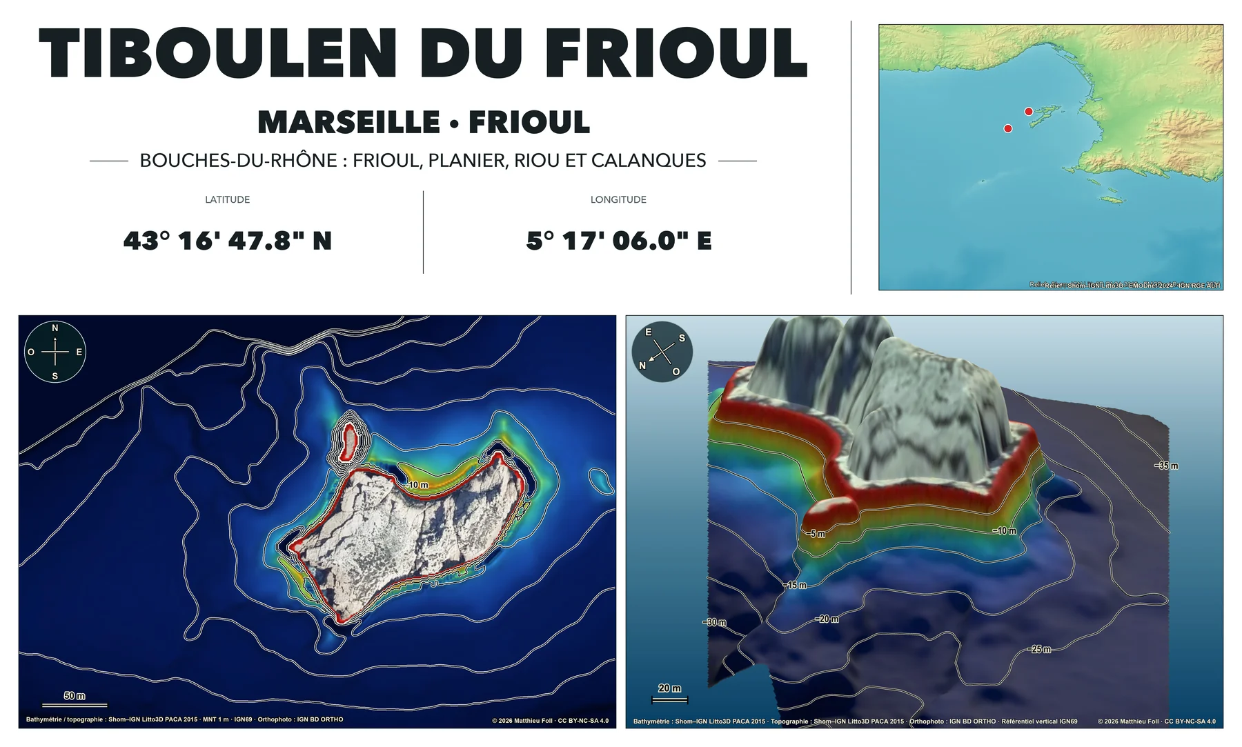
Published sites in Bouches-du-Rhône use the sources declared in their regional configuration.
Marine surfaces come from the 2015 Shom–IGN Litto3D PACA data, using a 1 m gridded terrain model.
The same Litto3D DTM supplies coastal land topography for the site maps, using the IGN69 vertical reference.
Aerial views use IGN BD ORTHO, with the capture date retained for each site.
Regional maps combine EMODnet 2024 offshore, Litto3D nearshore, RGE ALTI on land and official Shom–IGN land polygons for the coastline. GEBCO 2024 is used only as a NoData fallback.
The code and website interfaces were generated entirely with AI under human direction, then visually reviewed and validated against the source data.
Maps and visualisations © 2026 Matthieu Foll.
CC BY-NC-SA 4.0The production pipeline and website source code are available on GitHub.
View the GitHub repositoryThese maps are not intended for navigation and do not replace local information, sea conditions, guidance from authorities or professional advice.
Have a question or comment about the Bouches-du-Rhône maps?
Email me at contact@divetopo.com.

